Portfolio
Since late 2013, I have been expanding my spatial skills at home as
well as at work, and examples of this are as follows:
- Cartography/GIS: Using Vicmap and Geoscience Australia data
as the base and MapInfo software, I've created the following maps:
- GPS: Using a Magellan handheld GPS on loan (originally a
Triton and more recently an Explorist):
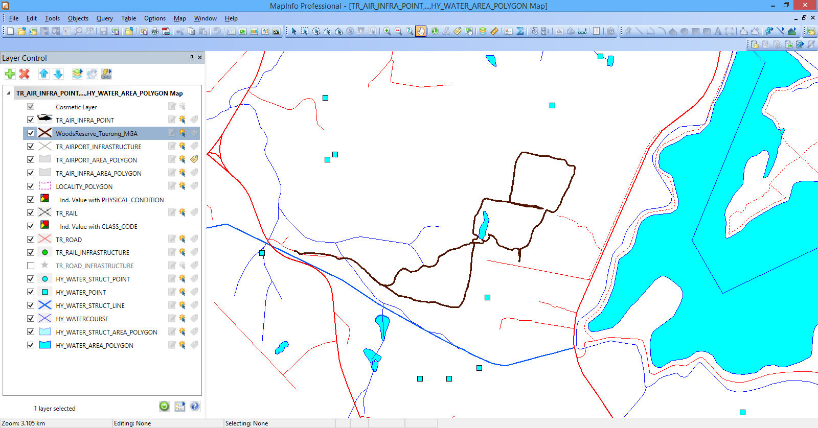
- I've picked up features such as walking tracks that aren't yet on
Melway or Vicmap. Using GIS software, I've converted the GPX files
to MapInfo format, then in MapInfo overlaid these on Vicmap data.
The resulting data is then sent off to Melway and Vicmap as needed.
See as examples a screen
dump for Woods Reserve (near Devilbend Reservoir, Mornington
Peninsula) and a screen
dump for Buckley NCR (Balnarring, Mornington Peninsula).
- Picked up plaques around Dromana for the Dromana and District
Historical Society.
- More recently, I now have a kit-build
GPS to use as well.
- Graphics:
- Racecourse
Maps (Mornington and Balnarring) from final year at RMIT uni,
using CorelDraw
- House
Plans, based on Year 12 graphics class, initially hand-drawn
but later re-drafted in CorelDraw
- KML: I've created Google Earth KML/KMZ files for a variety of
subjects using CAD/GIS software, view this
list and more recently the 'Round 2' work.
- Open Street Map: I've made a start on doing maps using Open
Street Map using Leaflet Javascript as the base instead of
Google, as follows:
- New maps
- Replacing maps that were on Google:
- Animated 3D Maps: Maps of the Puffing
Billy Railway and 4WD
- Talbotville to The Pinnacles via Billy Goat Bluff Track,
created using Memory
Map software (in it's 3D ability). Normally, you can do this
with a GPX file from a handheld GPS device, etc; but these involved
GPX tracks created using commercial or freeware/open-source CAD and
GIS software.
The latest - driving
from the Little River Gorge to McKillops Bridge - is from a GPX
track recorded using Memory Map on a smartphone while on a holiday.
- Multimedia: A multimedia
CD of Walhalla produced (as part of a group) while in final year
at RMIT Uni.
- Digital Twin: I have started looking at what simple maps can
be produced uploaded to the Digital Twin Victoria and the National
Map. A basic example for the latter is a few places
of astronomical interest in NSW, taken from the Quasar
Publishing website.
- Programming: A zipped
C++ program from RMIT Uni, showing a map projection. You will
need to download and install the DosBox
software as well to be able to run this program on more recent
versions of Windows.
I have also provided feedback to Melway since around 1996 and Vicmap
(Spatial Vision Map Books and Vicmap maps/digital data) since 2006 by
'unofficial' field-checking of the maps, and am now using a handheld GPS
to assist in this, combined with GIS.
In 2025, I set up an OpenStreetMap account and have started making a
number of additions and amendments on that, including using a smartphone
GPS to pick up features.
John Cleverdon, 2013-2026.
Email
me if you want to get more information about me.