Railway Map of Victoria
This site contains a railway map of Victoria, set up in bitmap
format.
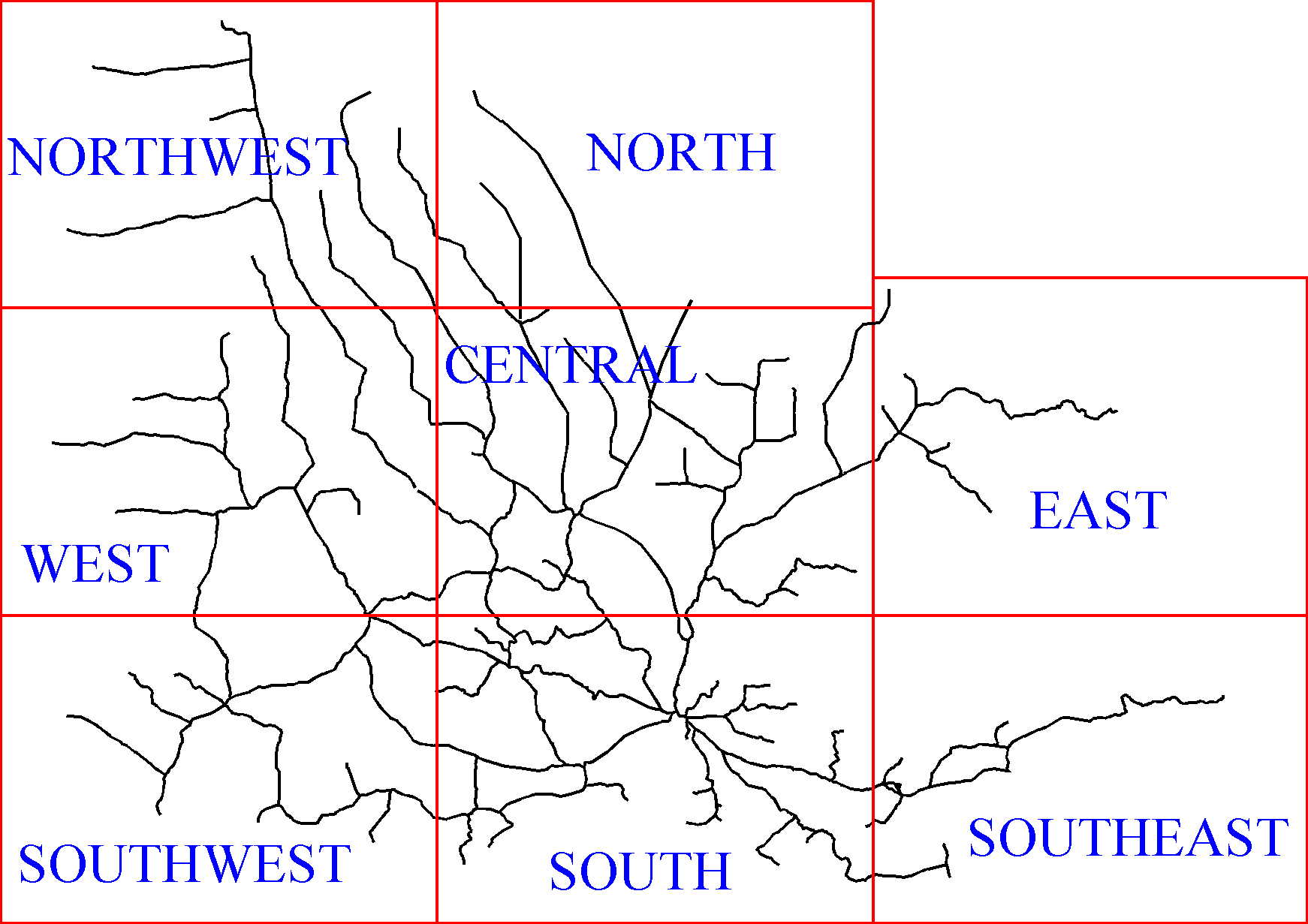
This is a clickable map; click on the relevant section to view
the detailed map. The only way to move between the detailed maps
is to come back to this page. There are scales and legends on each
of the 8 individual maps.
I have not included the Melbourne and Ballarat areas; this is
because they are too detailed for a map of this scale.
I also have available a copy of the map in Adobe PDF format. Click
here to download a copy of the map - 200 kB (it is a zip
file, so you will need WinZip or a similar program to unzip it).
This PDF file is around 1.4 MB in size unzipped. To view the PDF
map, you will need the free Adobe Acrobat Viewer, this can be
found at the Adobe
web
site.
Creation:
The idea for this map came from a similar site set up by Rolfe
Bozier, with railway maps of
New South Wales. After looking at his site, and getting tips
from him, I began planning this site.
Data Sources:
For the main lines, and later-closed branchlines, the data comes
from computers with MapInfo.
For the earlier-closed branchlines, and lines into NSW and SA,
the data came from a digitised 1:1 million scale map of Victoria
(using Microstation).
The sections of standard gauge from Melbourne to Albury and
Melbourne to Geelong were basic lines drawn parallel to the main
line, once in CorelDraw.
The station locations were based on larger-scaled maps.
The opening dates for the lines came primarily from a list in ARHS
Bulletin from a few years back.
Production Method:
Both sets of data were exported from the original programs as DXF
files, and then imported into CorelDraw. The two datasets were
merged, and where there were duplicated lines, the MapInfo data was
the data used, because it had higher accuracy.
With this done, the stations were added, and the lines were broken
up, according to their opening date. The lines were then
colour-coded.
Once this was complete, the original map was divided up into eight
segments, and each segment was individually exported as a GIF file.
Finally, these files were opened in PaintShopPro, where the station
names were added. Work was also done in CorelPhotoPaint.
The PDF map was produced simply by exporting the map from
CorelDraw.
Links:
Some other web sites with Australian railway maps:
Railway maps of New South
Wales by Rolfe Bozier. This is an excellent site, and
includes animated maps of the NSW network, along with detailed
maps of individual lines.
Railway maps of
Victoria by Andrew Waugh. An excellent series of maps,
dating every 10 years from 1860-2000 inclusive.
Railway
map of Victoria by Mark Bau (NOTE: this map is approx
1.2MB, and you will need Adobe Acrobat Reader to view it)
Railway maps of
Australia by Chris Brownbill
Signalling
diagrams for Melbourne by Chris Gordon
Railway
maps of Victoria by Chris Gordon
Railway maps of
Australia as KML (Google Earth) files by 'Hairylegs'
Vicmap Data
- Railways
South
Australian rail network - spatial data
2014
Railway Map of Australia by Geoscience Australia (note:
this is a 48MB PDF file)
Queensland
rail network - spatial data
© Copyright 1999-2014 John Cleverdon
Email: John
Cleverdon